Wednesday, March 28, 2012
3/28/12
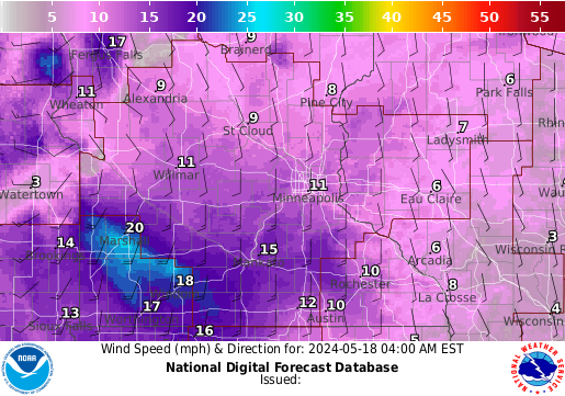
Today's weather was close to Eau Claire's average weather for this time of March. The high today got up to 56 and the winds are from the north at 10mph. There is a freeze warning in effect for the area tonight as the low temperatures are expected to drop below freezing. The cold frigid winds tonight will be from the NE at 10mph and due to the lack of cloud cover tonight this will allow the temperatures to plummet to the low 30's. Tomorrow's forecast is expected to be a sunny day with highs getting up to the upper 50's with winds from the north at 10mph. There will be a low pressure system moving in later tomorrow bringing with it a 70 percent chance of rain into tomorrow night and cloudy skies for Friday.
Tuesday, March 27, 2012
3/27/12
Today's forecast is a high of 70 degrees with a 30% chance of thunderstorms in the afternoon. This morning was 90 percent cloud cover (altostratus) and the winds were from the SW at 15 mph. There is a low pressure system sitting to our northwest right now and there is an occluded front moving through currently which will bring with it the rain/thunderstorms. After the front moves through, a cold front will bring with it cooler air and tomorrows high is only going to reach 50 degrees which is our average for this time of year. The winds will also pick up during the day and gusts could be as strong as 40mph at times. The cooler air and wind will last up until the end of the end with a warm up by Saturday to above average temperatures again!

Monday, March 26, 2012
3/26/12
Today is my first entry since spring break. The weather for today is mild with high around 50 degrees with a 40 percent chance of showers/thunderstorms during the day and a 70 percent chance at night. The low for tonight will be around 40 degrees. The warm front that has been pushing through will be replaced with a low pressure system and that will bring the precipitation into the region. The winds are from the ESE at 20 mph increasing to around 35 mph with 40 mph gusts at times. These winds helpsindicate that a low pressure system sitting to our south will bring the rain/thunder with it. These temperatures are cooler than what we have been seeing but are still a bit above average for March. So far in the month of March up until today there have been over 6000 records set across the United States. These warm temperatures are due to the location of the jet stream which is in Canada and should be farther south.

Thursday, March 15, 2012
weather 3/15/12
This will be my last post until after spring break. The weather already feels like I'm on spring break right now with the high for today reaching 68 degrees and a dew point of 50 currently. The winds are from SE at 10mph and the sky will be mixed with a few cumulus clouds with a high pressure system sitting to our north. Record high temperatures are still expected today and throughout the weekend into next week. There will be a slight chance of thunderstorms this weekend as a weak cold front is expected to move on through but otherwise the weather is going to be amazing in the Eau Claire area. The low for tonight will dip down to 42 due to the clear skies. 42 is close to our average temperature for this time of the year.


Wednesday, March 14, 2012
weather 3/14/12
The entire upper Midwest has been experiencing above average temperatures over the last few days and will continue into next week. The Eau Claire area could see 30 degree above average temperatures with highs reaching 75, something you would not see until mid May. These above average temps is not good news for farmers as it will hurt the crop growth and soil moisture. A strong southwest flow will be pumping humidity and warm temperatures from the gulf. Additionally, a warm front is hovering over the Eau Claire area with an occulated cold front to the west which will bring more clouds (cumulus) but no cooler temps. This is a very interesting weather pattern that we are experiencing, I have never seen temps this warm so early in the spring season. The last time we hit 75 in Eau claire during this time was in 1910.

Monday, March 12, 2012
3/12/12
Today's weather is very gloomy with rain showers on and off during the day, possibly a rumble of thunder in there as well. The chance of rain is 70% up until this afternoon late. The Eau Claire area is expected to get around a half inch of rain today and the high for today will be around 54 with a SSW wind at 10mph. Tonighty winds will switch and the skies should clear later tonight bringing with in above average warm temps almost 30 degrees above average. The high for Tuesday is going to be 65 and the high for Wednesday will be even warmer, 71 degrees shattering old records. This is a very warm start to spring and I wouldnt be surprised if there were thunderstorms in the up and coming future.
Sunday, March 11, 2012
weather 3/11/12
Today is another above average day with warm temperatures reaching above 60 degrees. However changes are in store for later today, already there are some cirrostratus and altostratus which shows that rain will be coming in the next 24 hours or so. This is true, there is a 70 percent chance of rain tonight and into tomorrow and the low will drop to 43 degrees. There is also a low pressure system to our south which will be pumping in the moisture and expected rain amounts or around an half inch. More warm record temps are expected to continue throughout the week and into spring break!


Wednesday, March 7, 2012
weather 3/7/12
Today's weather calls for more mild temperatures (around 50 degrees) with a 50% chance of thunderstorms! The cloud cover is thick (nearly 100%) mainly consisting of a low level stratus cloud deck. The winds are still blowing in from the southwest at around 15mph and is providing moisture/warm air and the barometer is falling. A cold front is moving through MN currently with some cooler air behind it, this scenario is a perfect setup to see some thunderstorms/rain today.In addition to the cold front a low pressure system sitting in Iowa is also associated with this front which could also cause some storms.


Tuesday, March 6, 2012
weather 3/6/12
Today a warm front is expected to move in bringing with in seasonally warm temperatures. This morning there were cirrus clouds and halos around the sun which meant that there was a front moving into the region. Winds were from the south at 5-10mph pumping warm air up into the area. Today's high was around 53 degrees but as the day progresses altostratus clouds have been moving in which means that rain is on the way in the next 24 hours. The low for tonight will be a balmy 41 degrees due to he increasing cloud cover, which means that the moisture that is evaporating today wont all escape. I'm sure there will be lots of rain and fog tomorrow, and the high for tomorrow will be around 45 degrees.
Monday, March 5, 2012
weather 3/5/12
Today's weather calls for a slow warming. As a warm front moves into the region and north throughout the day temperatures should be on the rise up to the mid 30's. Winds will then switch to the south and bring in warm gulf air. Tomorrow is expected to have very warm weather with highs in the 50's and will start to melt the snow causing lots of watery roads. Later in the week there is a slight chance of rain (40%) and temperatures will still be quite mild. Spring is on the way, just before spring break! Looking at Indiana and the horrific tornado outbreak, snow has moved into the region and has blanketed the devestated areas, thus making life even harder on the residents of those devestated towns. The image below shows how the outbreak began.

Sunday, March 4, 2012
weather 3/4/12
The area of low pressure to our south should move out the of region, and finally some sunshine should show up later on Sunday and into Monday morning. Temperatures today will be around 25 degrees and snow showers are still possible. Yesterday's snow totals were around an inch of powder. Warmer temperatures will be moving into the area by mid week with highs on Tuesday and Wednesday around 50 degrees! Spring is definitely around the corner. Additionally, the tornado stricken areas such as southern Indiana and now for casted to see snow on top of the already devastated area. It sure has been a strange winter!

Saturday, March 3, 2012
weather 3/3/12
Today's weather will be influenced by a low pressure system just sitting to the north. Overcast skies with low stratus clouds will be around the area throughout tomorrow and there will be a slight chance of snow again today. Currently it is 32 degrees and the winds are from the NW at 10mph. There has been a dusting of snow, but no significant accumulations. Throughout the rest of the day the eau claire area could possibly get another 1-2 inches of snow but that's about it. Other big highlights for weather include the horrific tornado outbreak in southern Indiana. More than 30 people have died and a few towns were wiped off the face of the map. Luckily, early warning systems warned the majority of the residents of the affected towns and the death total wasn't nearly as bad as it could have been.

Friday, March 2, 2012
weather 3/2/12
Another dreary day for the Eau Claire area with highs reaching 34 degrees. A bit of snow fell in the area last night at around 11pm and there still are many icy areas from the constant melting and freezing. Another system will be coming out of the southwest and heading towards Madison and Chicago. Eau Claire might get clipped by this storm but no significant precipitation is expected. There is a slight chance of snow today and into tonight (30%) and winds will be from the WNW at 10mph. Highs for next week are expected to reach the upper 40's, it appears that spring will be here soon after this already mild winter! For the south more tornados/severe weather is expected, and Alabama has already seen a few tornados this morning and damage has already been reported.
Subscribe to:
Posts (Atom)