Thursday, May 10, 2012
Interpolation maps in pictures page
Check out my interpolation temperature maps I made for Advanced GIS located in the pictures/videos page!
5/10/12
It is almost the end of school this semester and the weather is definitely cooperating. Today the skies are mostly clear with round 10-20 percent cloud cover and the clouds are cumulus. The winds are from the NW at 3 mph, the barometer is at 29.97 inches and dropping due to a low pressure system sitting out in the great plains moving in. The air is quite dry right now with a dew point of 38 degrees. Tomorrow as the low pressure system approaches, there will be a chance of thunderstorms, however no severe weather is expected! This is good for the last day of class tomorrow! Time to get ready for finals!
Wednesday, May 9, 2012
5/9/12
Today's high is expected to reach the mid 60's today. The cloud cover is around 30-40 percent and the type of clouds are cumulus. The skies are expected to clear more later i nthe afternoon and the winds are from the NNW at 10mph. The air is quite dry at 38 percent humidity and with this low humdity and sunny skies this will allow the temperature to drop tonight into the 40's. The tree pollen is at full force right now and my allergies are affecting me today with the calm winds.


Tuesday, May 8, 2012
5/8/12
Another dreary cloudy altostratus- nimbostratus later in the day for the eau claire area. There is a low pressure system sitting over northern Minnesota which will bring precipitation later in the day. Thee already is flooding in the region from the 2 inches of rain that we got on Saturday. Additionally, There is a cold front
stretching through Texas all the way up to Ohio which is bringing lots of rain up to 3 inches in places!


Monday, May 7, 2012
5/7/12
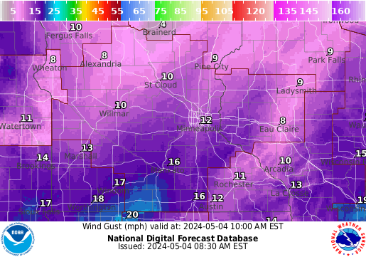
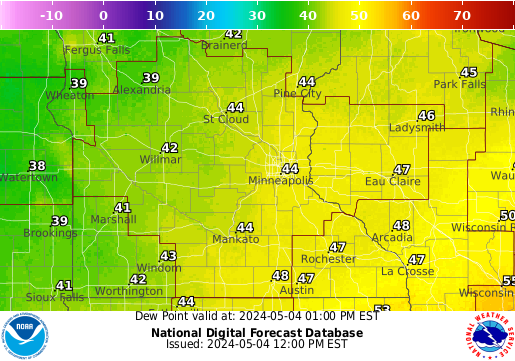
After a rainy weekend, some much needed sunshine is in the works for today. Today will be a high of around 70 degrees and the skies will have about 20 percent cloud cover only. the winds will be from the WNW 10mph and the low will drop down to around 40 degrees. Tomorrow a low pressure system will move in bringing with it rain and cloudy conditions along with cooler temperatures with highs only reaching to around 60 degrees.


Sunday, May 6, 2012
5/6/12
After a monsoon like day yesterday, the Eau Claire region received 1.83 inches of rain. Today's temperatures have dropped around 10 degrees from yesterday and the high for today will only get up to around 60 degrees. The sky is currently 100 percent cloud covered and the winds are light from the NE at 10mph. The cold front and low pressure system that brought all of the moisture is slowly moving into Illinois and providing the area with severe weather. There is still a lot of moisture in the air and the humidity is still 93% since the storm just recently moved through.

Saturday, May 5, 2012
5/5/12
Today's weather is expected to be cloudy and dreary with a 60 percent chance of thunderstorms during the afternoon hours. The temperature is 56 right now and isn't expected reach any record high today. The dew point is around 50 and the barometer is falling. The cloud cover is around 100 percent right now and there is severe weather to our west in southwest Minnesota right now. The is a bow echo line of storms moving our way and strong winds and small hail is expected.


Thursday, May 3, 2012
5/3/12
Strong thunderstorms are currently moving through the eau claire region, a gust of around 50-60 mph just came through and now the rain is coming down in buckets. The gust is due to the pronounced heavy inflow of air from the back of this little storm. The low pressure system is sitting over the twin cities right now and is helping to produce this convective thunderstorms. There is a possibility for more severe weather later today especially if the sun comes out to help warm up the air. The winds are from the NW at 20 mph with gusts. The humidity is around 90% and the dew point is 65 degrees. The high for today is going to be around 78 and the low for tonight will be around 50.


Wednesday, May 2, 2012
5/2/12
After an uneventful evening last night with the severe weather, today is going to be quite beautiful. It is currently 64 degrees with winds from the SW at 10mph and the dew point is 58 which is quite sticky. The high expected today is going to be above average again around 80 degrees with a 60 percent chance of severe thunderstorms moving in later in the night. Hopefully it will be much more lively than last night! The twin cities got 2 inch hail and a tornado touched down just south east of the cities near Hastings, MN!


Tuesday, May 1, 2012
5/1/12
After a very busy weekend I am back. The weather today is expected to be quite warm with highs reaching 77 degrees. The winds will be from the SSE at 20mph which is pumping lots of sticky moisture up from the gulf. The jet stream is hovering over the northern united states and if it decides to dip down farther later today this will be the recipe for severe weather in the northern plains. Tonight the low will be 61 degrees which is quite balmy from what we have been seeing as of late. There is a 50% chance of thunderstorms and possibly severe weather tonight and into tomorrow during the day. The high for tomorrow will be 80 degrees which is again above average and the winds will switch to the SSW at 10mph.


Tuesday, April 24, 2012
4/24/12
Today's weather was a beautiful 70 degrees with partly cloudy skies. The winds were from the NNE at 5mph and the dew point was 26 degrees. As a low pressure system moves into the great lakes area, there will be an overnight chance of showers/thunderstorms tonight and there will be a higher chance tomorrow in the afternoon. Behind the low pressure system will be below average temperatures again and cloudy skies for the weekend. This weather is certainly more seasonable trend wise than was the weather during March. The Nor'easter finally has moved out into the ocean and mostly dissapated. Below is a map showing the snowfall totals.


Monday, April 23, 2012
4/23/12
The weather today is partly cloudy skies with a temperature of 53 degrees currently. It is expected to be 60 degrees around 3pm today with winds NNW at 5-10mph. More clouds will be moving in tonight and the winds will switch to the S at 5mph and the low will be 39 degrees. The highs will be around average until Wednesday when a chance of showers will be moving into the area. In the northeast there are still periods of snow that will be moving in from the nor'easter that has been slamming the region. However there wont be as much accumulation as had been expected due to the high sun angle which causes the snow to melt before it can accumulate.


Sunday, April 22, 2012
4/22/12
Today's weather will be a bit below average temperatures (around 56) with partly cloudy skies and winds will be from the NE at 10mph. The weather will be around average until Wednesday when a slight chance of rain and cooler temps move in. In other areas of the country especially thee northeast, a Nor'easter has slammed into the upstate new york and Pennsylvania area dumping nearly a foot of snow on the region and bring 5 inches of rain along the coast.


Saturday, April 21, 2012
4/21/12
Today's weather will be below average temperatures with a 50 percent chance of rain later into the day around dinnertime. The high for today will be 53 degrees with winds from the south at 15mph with gusts to 20mph. The dew point is 30 degrees and the skies are mostly cloudy right now with alto stratus clouds dominating the sky. As the day progresses and the rain moves in the sky will be overcast and the winds will switch to the east. It appears that the rest of the weekend will be dreary and rainy and a slow warm up will occur next week.
Thursday, April 19, 2012
4/19/12
Another gloomy day for the region. Today's forecast calls for a 80% chance of rain showers later in the day around 3pm as a low pressure system moves to our south and pumps up moisture from the south. Currently, the winds are from the NE at 5mph and the barometer is rising slowly at 30.5mb. The temperature is 45 degrees and is expected to not get much higher than that today. The low for tonight is expected to hover around freezing with winds switching to the NNE at 15mph. tomorrow looks quite nice with slightly below average temperatures and the rest of the weekend looks again, gloomy.


Monday, April 16, 2012
4/16/12
Its been a strange 24 hours of weather in the Eau Claire area. Yesterday it was 75 degrees with a dew point of 55 degrees with winds from the WSW at around 30 mph. As a low pressure system and stationary front moved into the area last night it brought with it lots of rain, strong winds and tornadoes in Minnesota. Today especially in the morning there was snow showers and the temperatures got up into the upper 30's. Tomorrow is going to be round average again with highs in the 60's, but then a chance of rain will be in the forecast for Wednesday again. Very strange spring weather indeed.


Saturday, April 14, 2012
4/14/12
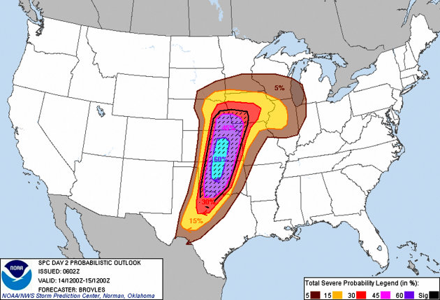
Today's weather is above average again with temperatures reaching around 71 degrees with winds from the south west at 10mph. The sky was clear this morning but as the low pressure system approaches the region the clouds have been rolling in with cumulus congestus clouds and now some stratus clouds as well. To our south there is a high threat for very severe storms stretching from Nebraska to Texas with the likelihood of a devastating tornado outbreak tonight and tomorrow morning. There is a chance for severe weather here as well but the likelihood is much smaller. We will however be getting thunderstorms tonight and tomorrow and the amount of precipitation will be around an half inch.



Friday, April 13, 2012
4/13/12
Today's weather was ominous and cloudy with highs only reaching 55 degrees. The dew point is quite high today and it has been raining/misting the entire afternoon with nimbostratus clouds dominating the sky. Tomorrows forecast calls for warmer weather to move in due to a warm front/low pressure system with highs reaching 73 degrees. The system will bring with it the possibility for severe weather tomorrow night and into Sunday morning as well. There is also the potential for tornadoes down south yet again due to this system.


Thursday, April 12, 2012
4/12/12
Today appears to be an amazing day with highs in the upper 50's to low 60's. The skies are mostly sunny with only around 10 percent cloud cover and the winds are from the SSE at 5mph. Tonight's forecast is looking like bonfire weather tonight with lows dropping into the low 40's and the winds increasing to 10mph. It is unfortunate that I cant partake as I have been sick the entire week with a fever! A low pressure system and stationary front will be moving into the region bringing with it a chance for rain and then a warm up for the weekend. However come next week Tuesday the temperatures will drastically drop again to the low 40's as high temperatures. A real bummer!


Tuesday, April 10, 2012
4/10/12
Today is the last day of below average temperatures for the region with our high only getting up to 45 degrees today. There is a warm up expected starting tomorrow and into the rest of the week. There is a high pressure system sitting to our northwest currently and a low pressure system and stationary front sitting to our south. Tonight's low will be the coldest it has been since early march with a low of 25 degrees with a possible freeze warning in effect as well. The winds are from the NW still but are dying down from where they were a day ago at nearly 25 mph. The record high for this day was 80 degrees, however we have already set a record of 80 degrees back in mid march. It certainly has been a strange 2012 weather year so far!


Monday, April 9, 2012
4/9/12
Today's weather was unseasonabley chilly with gihs only reaching 47 and strong winds from the NW at 25 mph. Currently it is cloudy out with stratus clouds moving int the region and will stick around up until midnight. As the clouds clear the temperatures are expected to plummet below freezing to around 28 degrees. For the next few days, temperatures will be at or above average with possibly rain moving in around the weekend as the jet stream will move north of the upper Midwest and will drop around California.


Sunday, April 8, 2012
4/8/12
After a very buy weekend I am able to finally make another posting. Since my last post, the weather has been feeling around average for this time in April. Today's ester weather was beautiful with little cloud cover with highs around 58 degrees. The winds have been very strong from the west at 25-30mph and there has been a fire weather advisory issued for the region. Additionally, tonights low will be falling below freezing so there is also a freeze warning out for the area as well. Tomorrows highs will be on the chilly side with highs only reaching 47 degrees and low dropping into the 20's! It hasn't been this cold since the start of March! With a high pressure system sitting to our south the weather looks nice for this week despite the chilly temperatures.


Thursday, April 5, 2012
4/5/12
Today's weather will be around average with highs around 57 degrees. The skies will be clear with almost 100 sunny skies. The dew point is around 26 degrees which is quite dry and the winds are from the ENE at 10 mph which will change later in the day to the E. Tonight's temperatures will drop again due to the lack of cloud cover and insulation from the cloud cover. The low for tonight will be around 30 degrees and there is possibility of a freeze. The average temperatures will last until Saturday when there will be a cold front/low pressure system moving in. This system will bring with it rain and colder temperatures below average for this time of the year; A first in the last month. To the south east there are still numerous severe alerts due tot he strong low pressure system spiraling around the gulf.


Wednesday, April 4, 2012
4/4/12
Today's weather will be around average with perfectly sunny skies and a high around 61 degrees. The winds will be from the NE at 10mph and the barometer is on the rise with a high pressure system moving in. Tonight's low will be below freezing as there will be no cloud cover to help insulate the temperatures. The weather will continue to stay like this up until the weekend when the next system will move in from the Pacific northwest with a possibility for thunderstorms. Despite the nice weather up in the Midwest Texas has been experiencing a horrific tornado outbreak, mainly due from a strong cold front that moved through the area yesterday and interacted with strong gulf moisture. This produced at least 12 tornadoes, destroyed thousands of homes and threw semi trucks into the air almost 50 feet. Despite the damage there were no deaths thankfully.
Tuesday, April 3, 2012
Texas Tornadoes Reported Near Dallas
Texas Tornadoes Reported Near Dallas: ABCNEWS.COM - Video shows funnel clouds and exploding transformers.
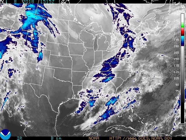
There is a strong low pressure system and cold front moving through Texas currently and this is providing the energy to produce these powerful tornadoes
There is a strong low pressure system and cold front moving through Texas currently and this is providing the energy to produce these powerful tornadoes
4/3/12
Last night's weather was quite wild with thunderstorms starting at around 1AM. The storms had a lot of lightning, wind and rain. The total rainfall from this storm was around 1.2 inches as of 8AM this morning. The storms were a result from a low pressure system funneling moisture in from the south. Now the system is sitting to our south east and providing the Chicago area with precipitation.Today's forecast calls for winds from the NNE at 12mph and the relative humidity is around 92% with a current temperature of 44 degrees. The Dew point is around 42 degrees which is creating the high relative humidity value. There is a line of stratus clouds that should be passing through the area later today which will bringing with it clear skies and a high of 63 degrees today. This will also provide a chilly low temperature of 33 degrees tonight.


Sunday, April 1, 2012
4/1/12
This April fools day is certainly foolish. The highs for today will break records again this year, starting April off with a bang. The high for today is 74 degrees with winds from the south at 10mph. The start of the day was chilly and cloudy but as a low pressure system and stationary front moved into the area the temperatures rose and the clouds diminished. As the low pressure system moves closer to the region there will be a chance for thunderstorms tomorrow and will also bring with it lower temperatures, much more seasonal. Today will definitely be the warmest day this entire week.
Wednesday, March 28, 2012
3/28/12
Today's weather was close to Eau Claire's average weather for this time of March. The high today got up to 56 and the winds are from the north at 10mph. There is a freeze warning in effect for the area tonight as the low temperatures are expected to drop below freezing. The cold frigid winds tonight will be from the NE at 10mph and due to the lack of cloud cover tonight this will allow the temperatures to plummet to the low 30's. Tomorrow's forecast is expected to be a sunny day with highs getting up to the upper 50's with winds from the north at 10mph. There will be a low pressure system moving in later tomorrow bringing with it a 70 percent chance of rain into tomorrow night and cloudy skies for Friday.
Tuesday, March 27, 2012
3/27/12
Today's forecast is a high of 70 degrees with a 30% chance of thunderstorms in the afternoon. This morning was 90 percent cloud cover (altostratus) and the winds were from the SW at 15 mph. There is a low pressure system sitting to our northwest right now and there is an occluded front moving through currently which will bring with it the rain/thunderstorms. After the front moves through, a cold front will bring with it cooler air and tomorrows high is only going to reach 50 degrees which is our average for this time of year. The winds will also pick up during the day and gusts could be as strong as 40mph at times. The cooler air and wind will last up until the end of the end with a warm up by Saturday to above average temperatures again!


Monday, March 26, 2012
3/26/12
Today is my first entry since spring break. The weather for today is mild with high around 50 degrees with a 40 percent chance of showers/thunderstorms during the day and a 70 percent chance at night. The low for tonight will be around 40 degrees. The warm front that has been pushing through will be replaced with a low pressure system and that will bring the precipitation into the region. The winds are from the ESE at 20 mph increasing to around 35 mph with 40 mph gusts at times. These winds helpsindicate that a low pressure system sitting to our south will bring the rain/thunder with it. These temperatures are cooler than what we have been seeing but are still a bit above average for March. So far in the month of March up until today there have been over 6000 records set across the United States. These warm temperatures are due to the location of the jet stream which is in Canada and should be farther south.
Thursday, March 15, 2012
weather 3/15/12
This will be my last post until after spring break. The weather already feels like I'm on spring break right now with the high for today reaching 68 degrees and a dew point of 50 currently. The winds are from SE at 10mph and the sky will be mixed with a few cumulus clouds with a high pressure system sitting to our north. Record high temperatures are still expected today and throughout the weekend into next week. There will be a slight chance of thunderstorms this weekend as a weak cold front is expected to move on through but otherwise the weather is going to be amazing in the Eau Claire area. The low for tonight will dip down to 42 due to the clear skies. 42 is close to our average temperature for this time of the year.


Wednesday, March 14, 2012
weather 3/14/12
The entire upper Midwest has been experiencing above average temperatures over the last few days and will continue into next week. The Eau Claire area could see 30 degree above average temperatures with highs reaching 75, something you would not see until mid May. These above average temps is not good news for farmers as it will hurt the crop growth and soil moisture. A strong southwest flow will be pumping humidity and warm temperatures from the gulf. Additionally, a warm front is hovering over the Eau Claire area with an occulated cold front to the west which will bring more clouds (cumulus) but no cooler temps. This is a very interesting weather pattern that we are experiencing, I have never seen temps this warm so early in the spring season. The last time we hit 75 in Eau claire during this time was in 1910.


Monday, March 12, 2012
3/12/12
Today's weather is very gloomy with rain showers on and off during the day, possibly a rumble of thunder in there as well. The chance of rain is 70% up until this afternoon late. The Eau Claire area is expected to get around a half inch of rain today and the high for today will be around 54 with a SSW wind at 10mph. Tonighty winds will switch and the skies should clear later tonight bringing with in above average warm temps almost 30 degrees above average. The high for Tuesday is going to be 65 and the high for Wednesday will be even warmer, 71 degrees shattering old records. This is a very warm start to spring and I wouldnt be surprised if there were thunderstorms in the up and coming future.
Sunday, March 11, 2012
weather 3/11/12
Today is another above average day with warm temperatures reaching above 60 degrees. However changes are in store for later today, already there are some cirrostratus and altostratus which shows that rain will be coming in the next 24 hours or so. This is true, there is a 70 percent chance of rain tonight and into tomorrow and the low will drop to 43 degrees. There is also a low pressure system to our south which will be pumping in the moisture and expected rain amounts or around an half inch. More warm record temps are expected to continue throughout the week and into spring break!


Wednesday, March 7, 2012
weather 3/7/12
Today's weather calls for more mild temperatures (around 50 degrees) with a 50% chance of thunderstorms! The cloud cover is thick (nearly 100%) mainly consisting of a low level stratus cloud deck. The winds are still blowing in from the southwest at around 15mph and is providing moisture/warm air and the barometer is falling. A cold front is moving through MN currently with some cooler air behind it, this scenario is a perfect setup to see some thunderstorms/rain today.In addition to the cold front a low pressure system sitting in Iowa is also associated with this front which could also cause some storms.


Tuesday, March 6, 2012
weather 3/6/12
Today a warm front is expected to move in bringing with in seasonally warm temperatures. This morning there were cirrus clouds and halos around the sun which meant that there was a front moving into the region. Winds were from the south at 5-10mph pumping warm air up into the area. Today's high was around 53 degrees but as the day progresses altostratus clouds have been moving in which means that rain is on the way in the next 24 hours. The low for tonight will be a balmy 41 degrees due to he increasing cloud cover, which means that the moisture that is evaporating today wont all escape. I'm sure there will be lots of rain and fog tomorrow, and the high for tomorrow will be around 45 degrees.


Monday, March 5, 2012
weather 3/5/12
Today's weather calls for a slow warming. As a warm front moves into the region and north throughout the day temperatures should be on the rise up to the mid 30's. Winds will then switch to the south and bring in warm gulf air. Tomorrow is expected to have very warm weather with highs in the 50's and will start to melt the snow causing lots of watery roads. Later in the week there is a slight chance of rain (40%) and temperatures will still be quite mild. Spring is on the way, just before spring break! Looking at Indiana and the horrific tornado outbreak, snow has moved into the region and has blanketed the devestated areas, thus making life even harder on the residents of those devestated towns. The image below shows how the outbreak began.


Sunday, March 4, 2012
weather 3/4/12
The area of low pressure to our south should move out the of region, and finally some sunshine should show up later on Sunday and into Monday morning. Temperatures today will be around 25 degrees and snow showers are still possible. Yesterday's snow totals were around an inch of powder. Warmer temperatures will be moving into the area by mid week with highs on Tuesday and Wednesday around 50 degrees! Spring is definitely around the corner. Additionally, the tornado stricken areas such as southern Indiana and now for casted to see snow on top of the already devastated area. It sure has been a strange winter!


Saturday, March 3, 2012
weather 3/3/12
Today's weather will be influenced by a low pressure system just sitting to the north. Overcast skies with low stratus clouds will be around the area throughout tomorrow and there will be a slight chance of snow again today. Currently it is 32 degrees and the winds are from the NW at 10mph. There has been a dusting of snow, but no significant accumulations. Throughout the rest of the day the eau claire area could possibly get another 1-2 inches of snow but that's about it. Other big highlights for weather include the horrific tornado outbreak in southern Indiana. More than 30 people have died and a few towns were wiped off the face of the map. Luckily, early warning systems warned the majority of the residents of the affected towns and the death total wasn't nearly as bad as it could have been.


Friday, March 2, 2012
weather 3/2/12
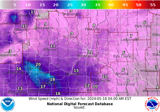
Another dreary day for the Eau Claire area with highs reaching 34 degrees. A bit of snow fell in the area last night at around 11pm and there still are many icy areas from the constant melting and freezing. Another system will be coming out of the southwest and heading towards Madison and Chicago. Eau Claire might get clipped by this storm but no significant precipitation is expected. There is a slight chance of snow today and into tonight (30%) and winds will be from the WNW at 10mph. Highs for next week are expected to reach the upper 40's, it appears that spring will be here soon after this already mild winter! For the south more tornados/severe weather is expected, and Alabama has already seen a few tornados this morning and damage has already been reported.

Wednesday, February 29, 2012
weather 2/29/12
Unfortunately, classes were not cancelled today due to the weather, however high schools throughout the area and into MN were cancelled due to icey roadways and snow. As of last night the pressure system was still to our south and was pumping up moisture with winds from the east/southeast. Around 10pm last we had already received around 5.5 inches of snow, but the precipiation then changed over to a freezing rain. There were a few acciendet along state street last night as well due to the icy conditions. There is more rain and ice to our south and evn further south there are tornado watches and warnings takking place. More than 15 tornadoes have already occured on the southern edge of this system and more are expected in the southeast today. In Branson, MO there have been already 13 deaths associated with the tornado outbreak and more tornadoes are moving into southern Kentucky. Currently, the snow total is now up to 7.7 inches and the low pressure system is sitting right over the twin cities area and is spinning counterclockwise. However the system is now dying due to the occluded front associated with it. See map below. Snow expectations are around 2-3 inches for today and the winds are now from the south at 20mph. Addionally, the barometer has been steadily dropping since last checked around classtime yesterday.


Precip totals so far


Precip totals so far
Tuesday, February 28, 2012
weather 2/28/12
This storm that formed out in the Rockies also known as a Colorado low, will be the most significant storm for this entire winter. However, it appears that the worst of the storm will pass north of Eau Claire which is unfortunate for all of those, including myself who were hoping for classes to be cancelled tomorrow. The Eau Claire area is only expected to receive around 1-3 inches of snow, along with sleet, ice, and rain mixed in at times as well. There is also a small chance for there to be ice accumulating throughout the rest of Tuesday and into Wednesday morning. Regardless travel will be very hazardous and especially with the ice/sleet is not advised. As the low pressure system moves into the upper midwest moisture from the gulf will pump up into the region providiign the areas north where the system is moving with abundant snowfall, up to a foot in places or more. Areas to the south in the moist warmer air will recieve less snow, or just recieve rain/ice. Currently, the temperature is just above freezing and the winds are from the SE at 10mph. This is good news that there will be at least some snow in the afternoon. The graphics below illustrate the storm and its predicted track.
![]()


Subscribe to:
Posts (Atom)

